A relaxing drive through Pretoria
Do you feel like taking a morning or afternoon drive through the streets of Pretoria? This drive around the inner part of the city can take anything from 2 – 5 hours and will take you past some of the landmarks in Pretoria.
The 20 km route will mostly take you through the Old East of Pretoria. It attempts to avoid busy and congested roads and is filled with many scenic viewpoints. The drive will make for a relaxing Sunday drive and even works as a quick sunset drive. The route is not an attempt to connect all the major tourist attractions in Pretoria but will give visitors a glimpse and feel of what to see and experience within the city of Pretoria.
Along the way is however a must-see attraction: the Union Buildings. Other highlights on the drive include the Loftus Versfeld Rugby Stadium and Klapperkop Nature Reserve. Pretoria’s other must-sees like the Voortrekker Monument and Freedom Park are not on the route but are visible from the various viewpoints and stops along the way.
1. Dining in Brooklyn
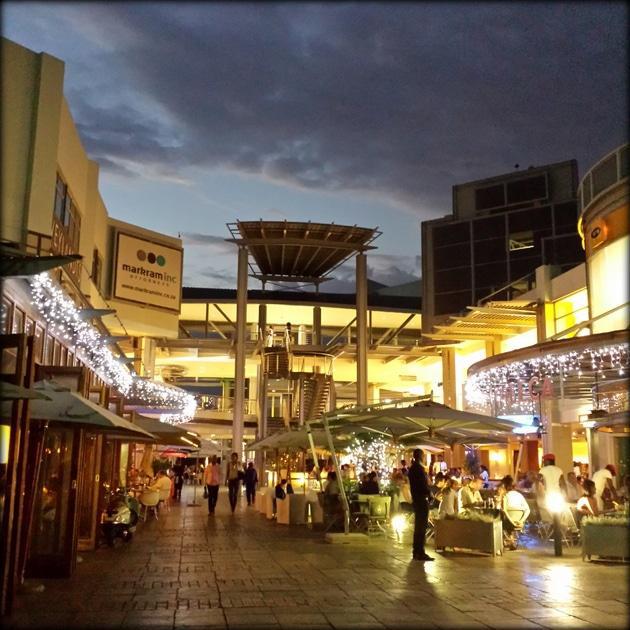
First stop is breakfast, (or brunch, lunch, etc. depending on when you plan to start your journey). A perfect place for this is Brooklyn Square, one of Pretoria’s trendiest restaurant spots. Here many restaurants have outdoor seating and it’s a pleasant way to start the day. As the square is linked to the Brooklyn Mall, it’s also ideal for getting supplies for the day, be it drinks, snacks or some sunblock.
If you’re not a fan of malls, the nearby brand new The Club in Hazelwood also has a very trendy and stunning outside setup but has a smaller selection of restaurants.
On Saturdays, a perfect place to grab a bite and get some picnic food would be the nearby Hazel Food Market in Menlo Park.
Read more about: Brooklyn Design Square
2. Groenkloof
After a hearty meal, the journey can start. Make your way to Middle Street or Brooklyn Circle and drive west towards Fountain Circle. Follow Middle Street all the way until it becomes George Storror Street and continue on this road all the way through Groenkloof.
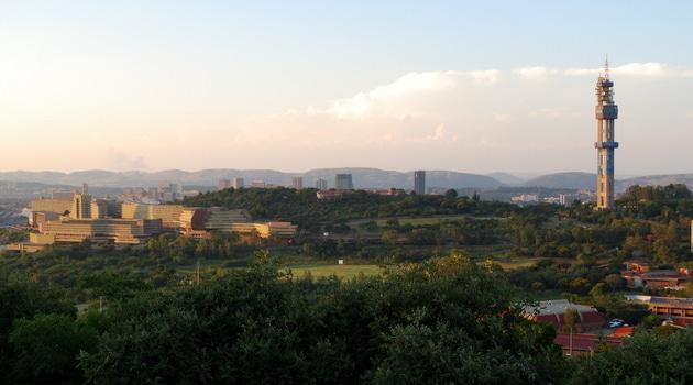
On your right, as you drive along George Storror, you’ll see the Muckleneuk Ridge with the Telkom Tower on top. Next to this you will see the University of South Africa (UNISA) building, one of the biggest long distance universities in the world and a popular landmark in Pretoria.
At the roundabout, known as Fountains Circle, take the 1st exit onto Nelson Mandela Drive/R21. Fountains Circle is one of the most popular entrances to Pretoria. The fountain dates from 1955, installed to celebrate the city’s centenary. The flagpoles were added for the 1995 Rugby World Cup, while the sphere and other additions were added for the 2010 Soccer World Cup.
At the circle, keep left and take the first exit along Nelson Mandela Drive away from the city for about 1.3 km and see the sign for Klapperkop Nature Reserve. On your right hand side you will now drive past the Groenkloof Nature Reserve and you might even spot some giraffes along the fence.
Turn left onto Johann Rissik Drive. This is the main road that will take you along and through the Klapperkop Nature Reserve (access is free).
3. Driving along Klapperkop Hill
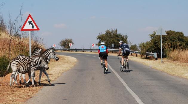
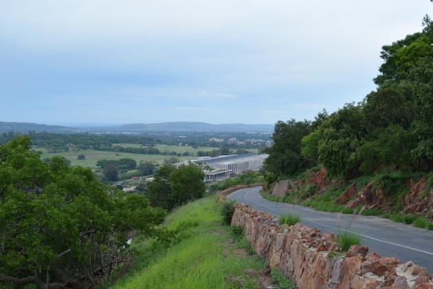
Not only is Klapperkop Hill now a nature reserve, which will give you a chance to see some wild zebra, red hartebeest and blue wildebeest, but it also provides visitors with sweeping views over most of Pretoria.
If you’re interested in history, make a quick stop at Fort Klapperkop (completed in 1898), which is one of Pretoria’s four remaining forts built to protect the city. It’s now a museum (there is a small entrance fee) and has a 360 degree view over Pretoria.
Read more about: Klapperkop Nature Reserve
4. Follow Johann Rissik Drive all the way through Waterkloof
After stopping on the many view points along Johann Rissik Drive, keep on heading east and leave the nature reserve.
Continue on Johann Rissik Drive and follow it through the suburb of Waterkloof where many of Pretoria’s wealthiest residents live and also where most of the city’s many diplomatic residences can be found. Waterkloof was also where many of the apartheid regime’s elite had their homes.
Follow Johann Rissik Drive all the way to the end, till you reach Rigel Avenue and turn left into Rigel Avenue.
Past Magnolia Dal to Loftus
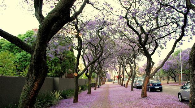
Follow Rigel Avenue, with its thick Jacaranda lanes, for 2 km down the hill till it becomes Florence Ribeiro Street. Continue on Florence Ribeiro, past George Storror for about 2 km.
On the way you will pass the Austin Roberts Bird Sanctuary on your right.
After 2 km you will see the beautiful Magnolia Dal on your right. Magnolia Dal is one of the most popular parks in Pretoria, and features a kid’s playground as well as a restaurant on the premises. It also plays host to an arts and craft market once a month.
Read about Magnolia and other parks in Pretoria: Pretoria Parks
After Magnolia Dal immediately turn right into University Road.
Cross the intersection and turn left into Walton Jameson Avenue (under the Gautrain Bridge).
In Walton Jameson Road take the first right into Jorrissen Street and follow this street till you reach the circle 300 m later.
Around the circle you will see the Afrikaanse Hoër Seunskool, the bus stop for Pretoria’s Bus Rapid Transport System, called A re Yeng, and the beautiful Oos Kerk which is regarded as one of Gerard Moerdyk’s finest works and is a National Monument.
At the circle turn left into Kirkness Street and you will see Loftus Versfeld on your right. There is a parking lot in front of the shops and restaurant (gate less than 100 m from circle on Kirkness Street).
6. Loftus Versfeld
The stadium is the heart of Pretoria’s sport culture and the home of the Blue Bulls Rugby team. The stadium grew from humble beginnings into a world class Rugby and Football Stadium which now can seat around 50 000 spectators. Loftus has successfully hosted matches for the 1995 Rugby World Cup and the 2010 FIFA World Cup.
At a restaurant located on the premises you can have a drink and watch the Blue Bulls practice on the B-Field, next to the stadium.
Read more about: Loftus Versfeld – more than just a rugby field
7. Driving through Arcadia, Pretoria’s second oldest suburb
From Loftus head north on Kirkness Street, which after 500 m will become Eastwood Street. Note the beautiful High Commission of India on the corner of Frances Baard Street. Pretoria has over 130 embassies or high commissions and most of them can be found in Arcadia.
Further down Eastwood Street, you will also pass a small Shopping complex called Eastwood Village on the left which has some nice cafes as well as a grocery shop if you need some picnic supplies for the Union Buildings’ lawns.
Follow Eastwood Street up the hill till you reach Government Avenue (about 1.5 km form Loftus). At Government Avenue turn left and follow the road all the way till you get to the parking right in front of the Union Buildings.
See a list of: Pretoria Embassies and Consulates
8. Last stop Union Buildings!
The beautiful Union Buildings is a must-see for anyone passing through the city. Even though the building is not open to the public, the lawns in front of it have free entry and will provide you with more than enough photo opportunities of the grand Union Buildings.
From the terraced garden you’ll also have magnificent views over the city and other landmarks, like the Voortrekker Monument and Freedom Park.
The Mandela Statue takes centre stage in the gardens and is one of the city’s most popular attractions.
Read more about the: The Union Buildings
9. End trip via Tom Jenkins Drive
From Government Avenue we now turn back the way we came towards Eastwood Street. While driving along Government Avenue between the Union Buildings and Eastwood Street, you will notice the double lane jacaranda trees on either side. The reason for this are that they were to provide shade for government officials walking to the Union Buildings from Bryntirion Estate.
After 1 km you’ll reach Eastwood where you turn left and follow it up the hill, turn slightly right, over the crescent where it becomes Tom Jenkins Drive. Tom Jenkins Drive offers a 180-degree view over the leafy suburbs of Rietondale, Riviera, Villieria and more. Follow Tom Jenkins down the steep decent along Meintjieskop, with the magnificent OR Tambo Building (home to South Africa’s Department of International Relations and Cooperation) lying on the eastern side of the road. When you reach Soutpansberg Road you are free to follow your GPS home.
Related Post: The Jacaranda City
 For a detailed step-by-step list of directions click map at top of page or visit the Pretoria Drive on Google Maps for more details.
| Pretoria must-see attractions |
Book your accommodation right here on ShowMe.
You can find the top hotels, lodges and Airbnb establishments conveniently placed on the map below. All you need to do is click on the place that’s conveniently located and within your budget and then make a booking. What could be easier?
If the map is not where you want to be, click on the ShowMe Pin and then enter the exact name of the location and the map will adjust accordingly.


